Bolivia

The Spectacular Southwest...of Bolivia! by Maya Yette

One of the few facts I knew about Bolivia before visiting, besides the fact that it sits at an insanely high altitude, is that it is home to the largest salt flats in the world, Salar de Uyuni, which are about 4,000 square miles. A visit to the salt flats was one of the few side trips I knew I had to take this year and it did not disappoint.

Unbeknownst to me was the fact that the southwest region of Bolivia where the salt flats are located, Potosi, is also home to a wide array of other, equally stunning landscapes. In order to see them all, a group of us signed up for a three day, two night tour that took us to some of the furthest reaches of Bolivia.  

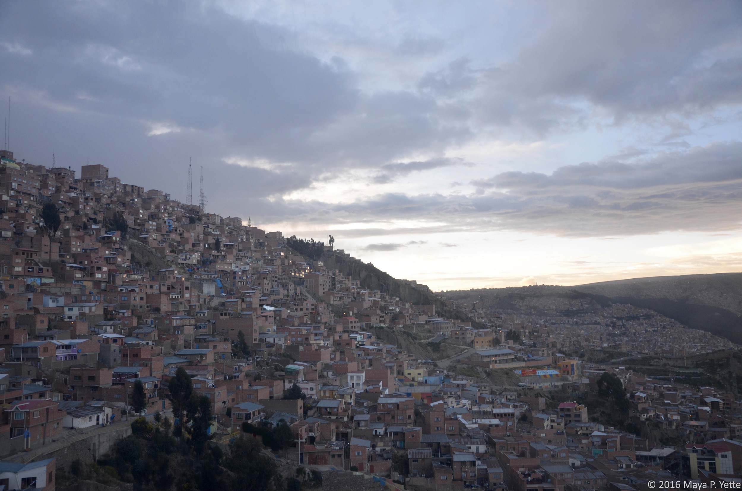
To get to the city of Uyuni, the jumping off point for the salt flats, we took a 10-hour overnight bus from La Paz (not as bad as it sounds, I promise). Upon arrival in Uyuni, we had breakfast and then met our tour guide, Nadia, and split into three jeeps that would be our refuge over the next few days. Our first stop right outside of Uyuni was a “train graveyard” where trains that were used to transport minerals across British-engineered rail lines to the Pacific during the late 19th and early 20th centuries now sit abandoned.

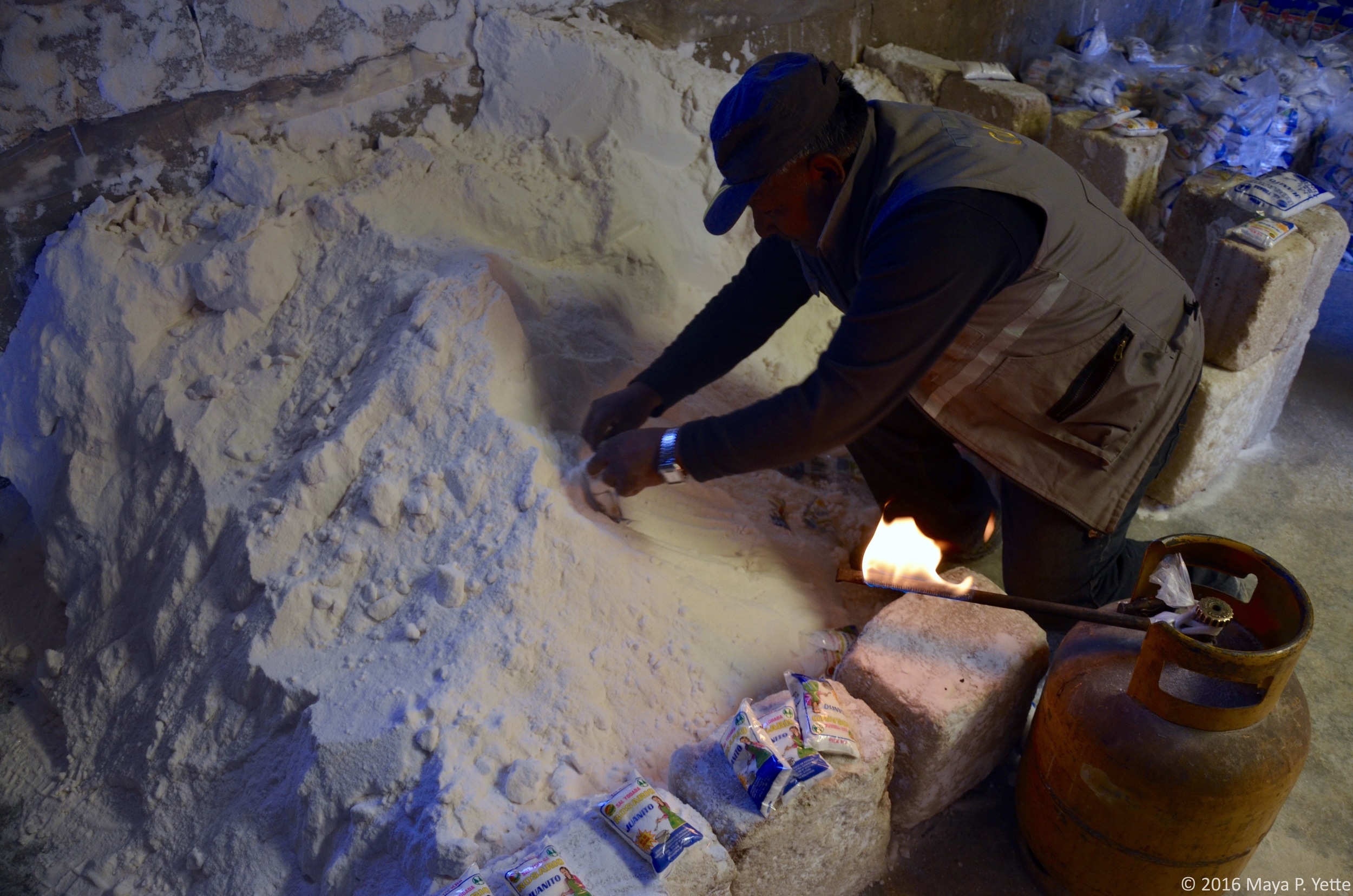
After climbing through and on top of old, rusted out trains that would certainly not be open as a tourist attraction in the United States, we made our way towards the salt flats. Before we could see this natural wonder, we stopped in the town of Colchani to see a salt processing plant, where people bring the salt they harvest from the flats and process it to sell.

As we left Colchani behind and entered the salt flats, our driver, Freddy, picked up speed and soon all we could see was the flat white expanse spreading out around us. We made a few different stops on the salt flats to observe the different areas. First, on the part of the salt flats closest to Colchani, there are a number of small pyramids of salt that people create to let the water run back into the ground and dry the salt out.

A little deeper into the flats there was an area that was covered in about 2 centimeters of water, which created a slight mirror effect. We stopped here to walk around and have lunch: llama steak and quinoa, staples of the Bolivian diet.

After lunch, we drove to see the first salt hotel (the bricks of the building are made of salt), which has since been closed because of the destruction it began to cause to the surrounding environment.

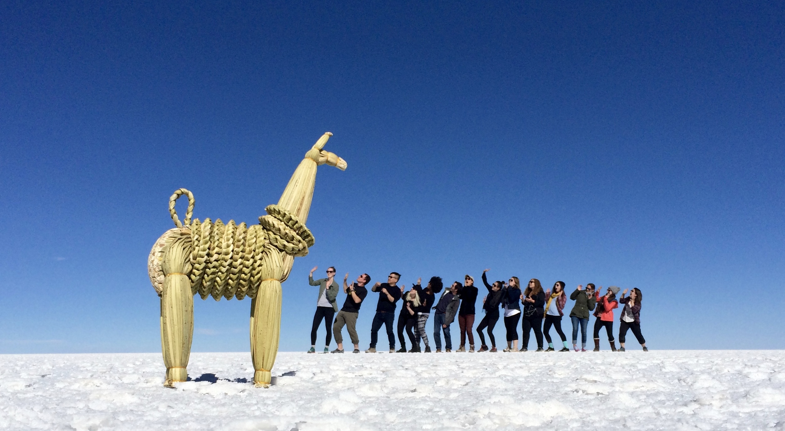
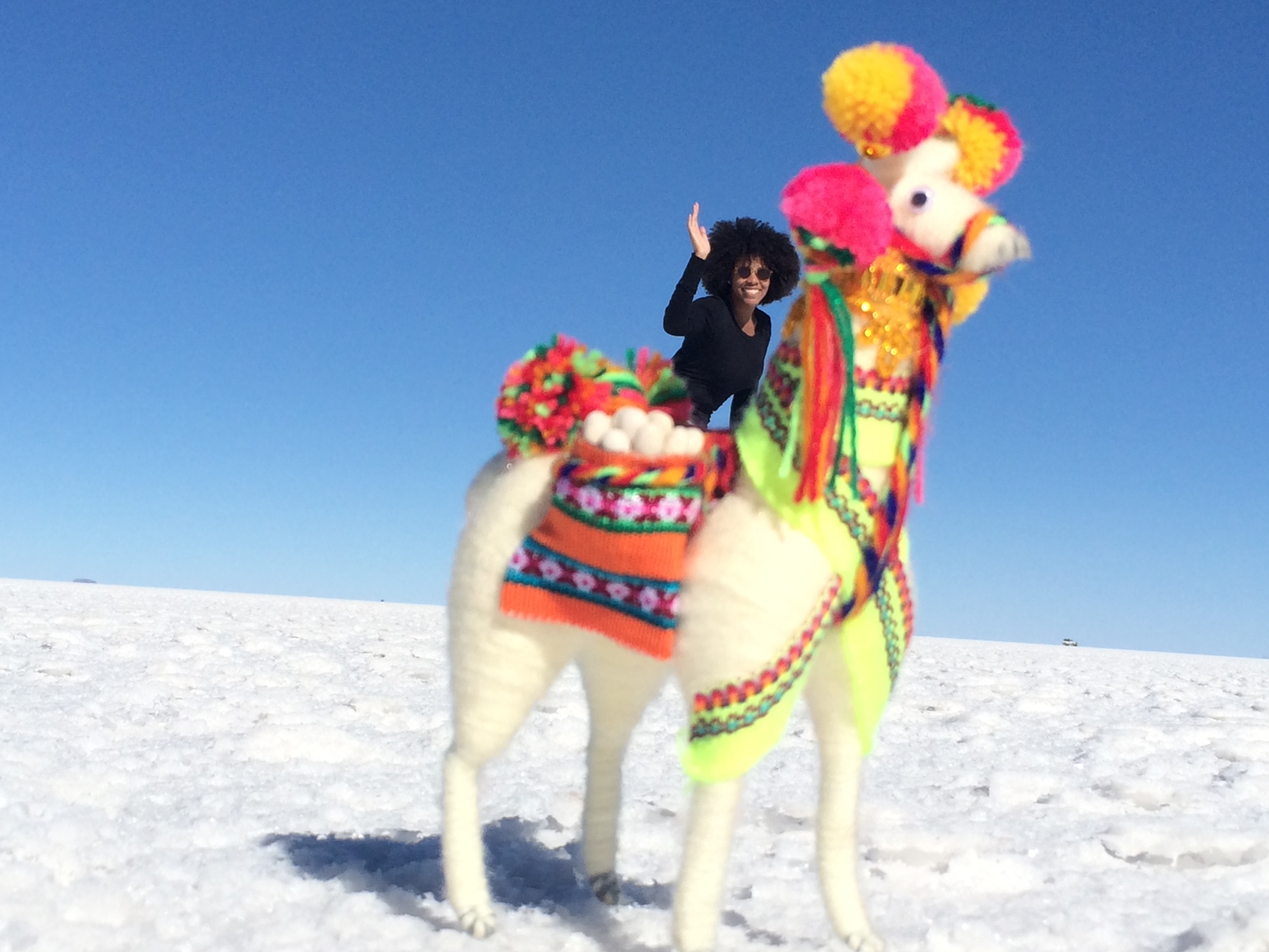
After driving even deeper into the salt flats, we stopped in a seemingly never ending expanse of white to take the silly, perspective bending photos that the salt flats are known for -- llama props were a crowd favorite.

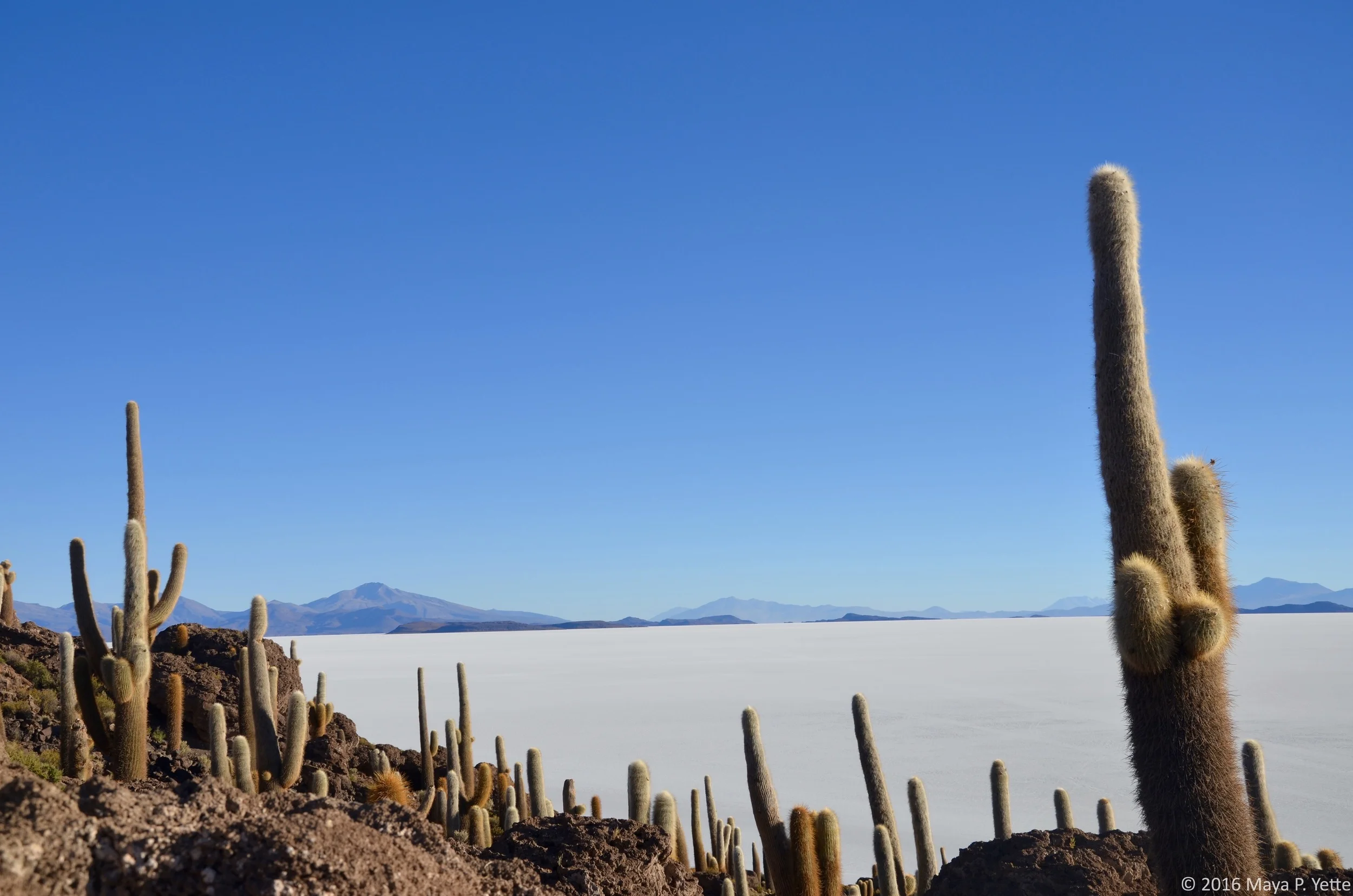
My favorite part of the day, however, was arriving at Isla Incahuasi, an “island” in the middle of the salt flats that’s covered in cacti. The contrast was unexpected and beautiful -- from the top of the island you can really imagine that the salt flats were once a lake.

As we drove out of the salt flats, we stopped to take in the sunset before heading to our hostel. 

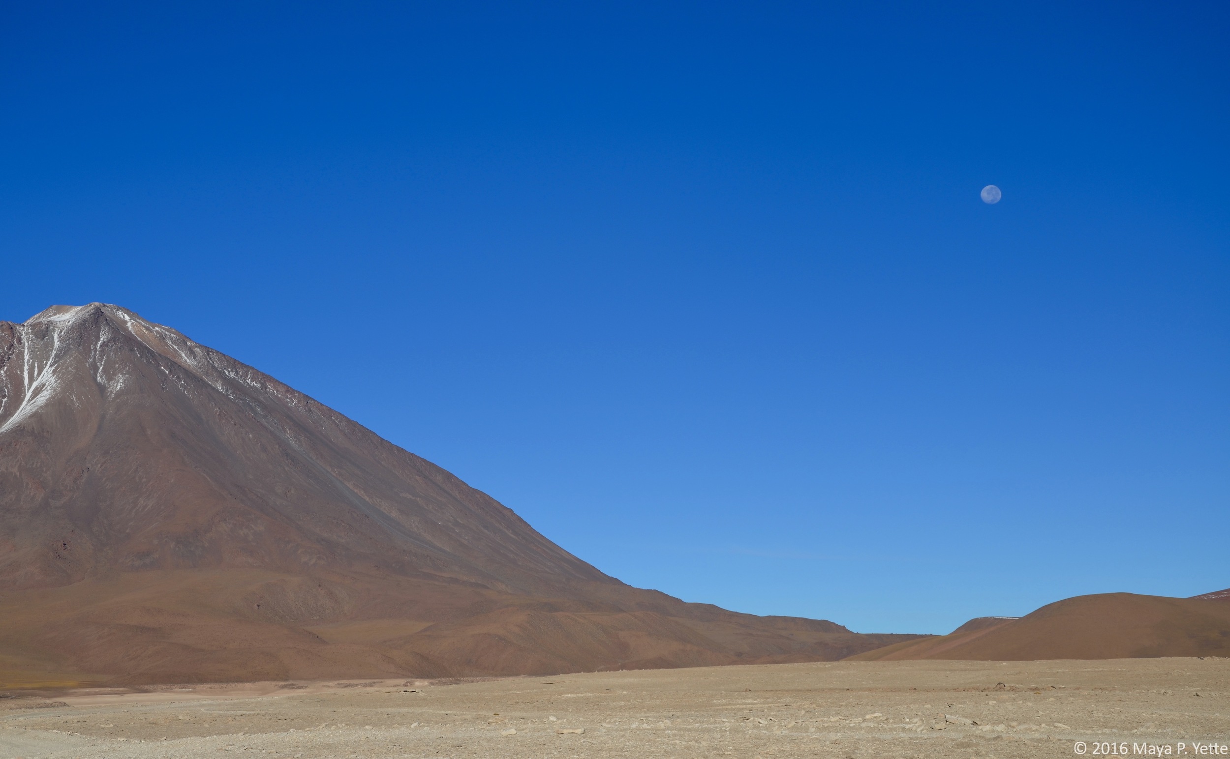
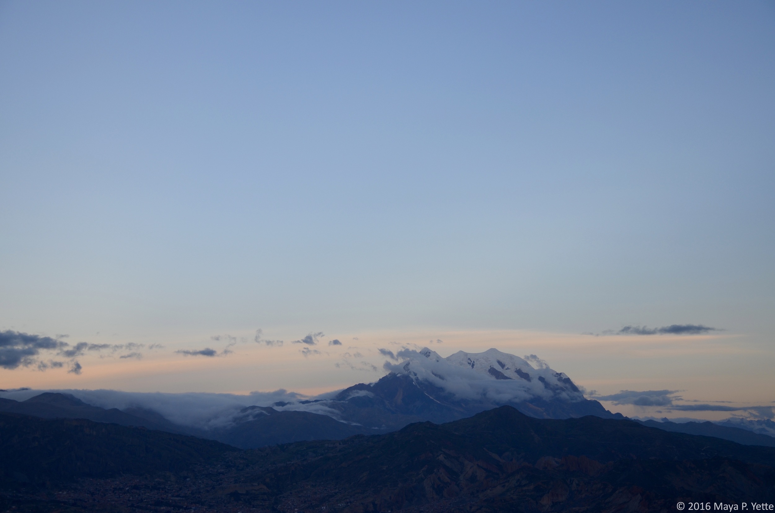
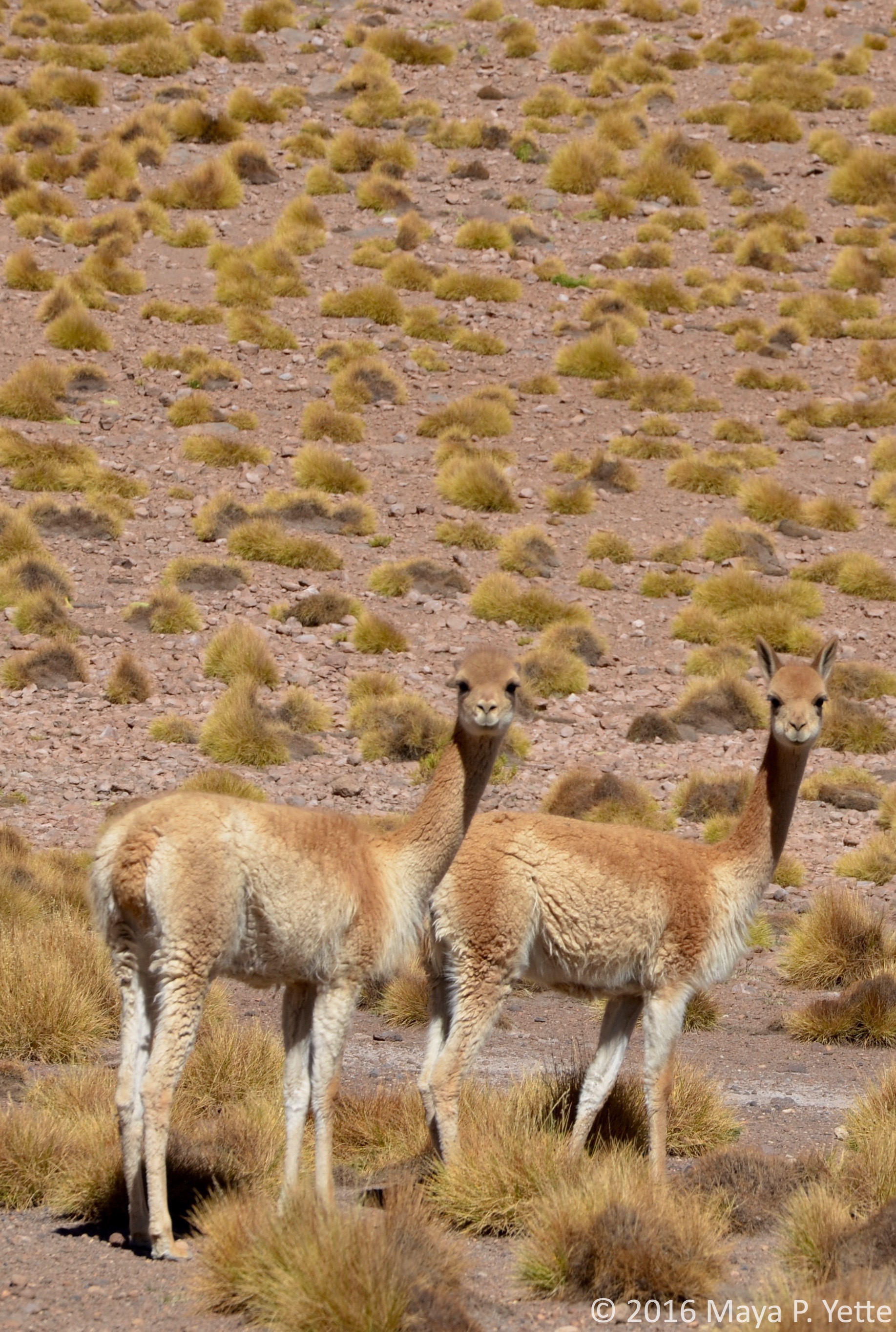
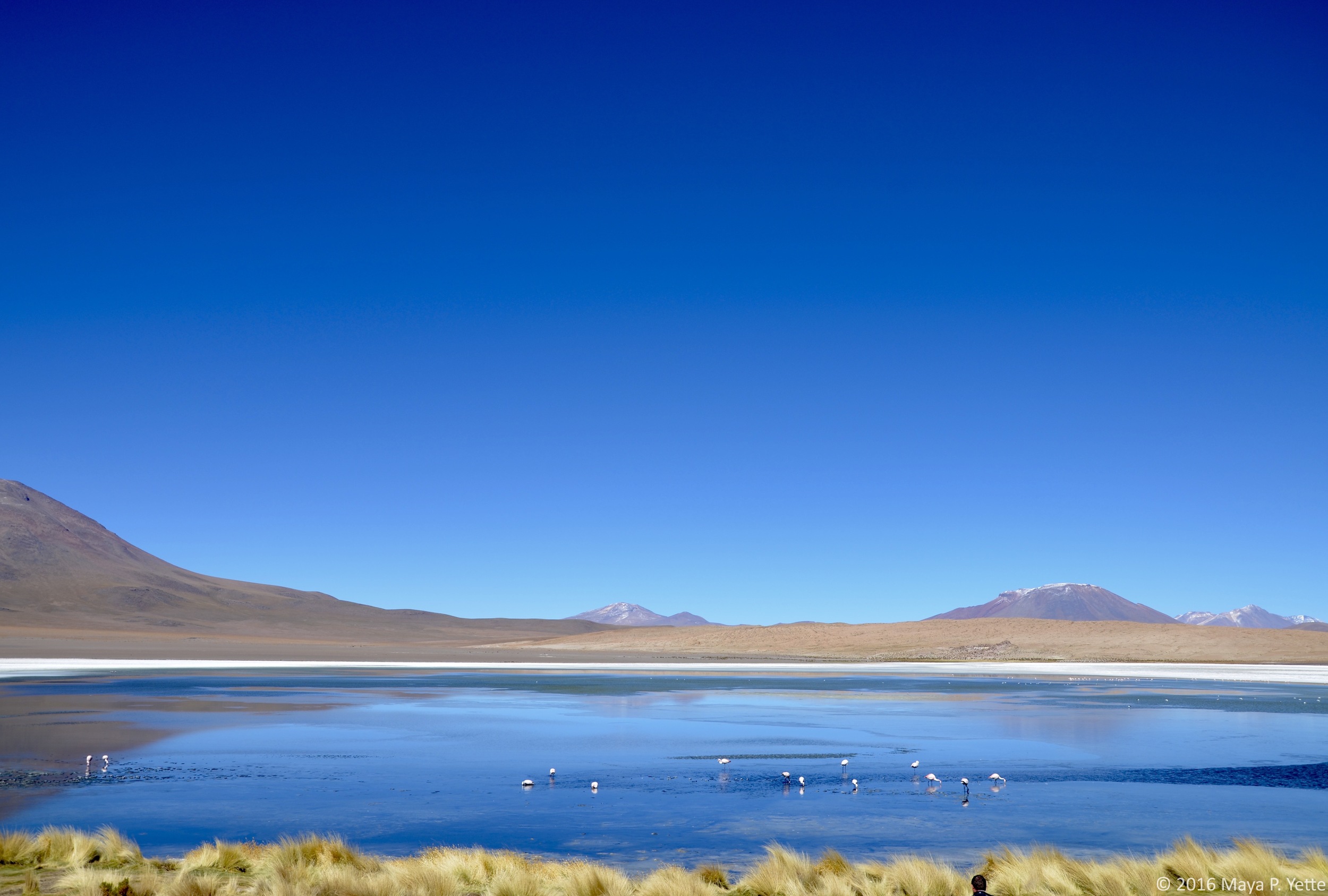
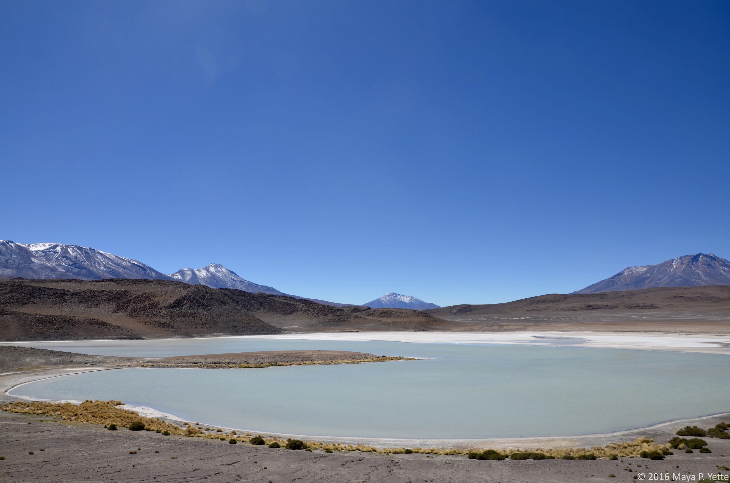
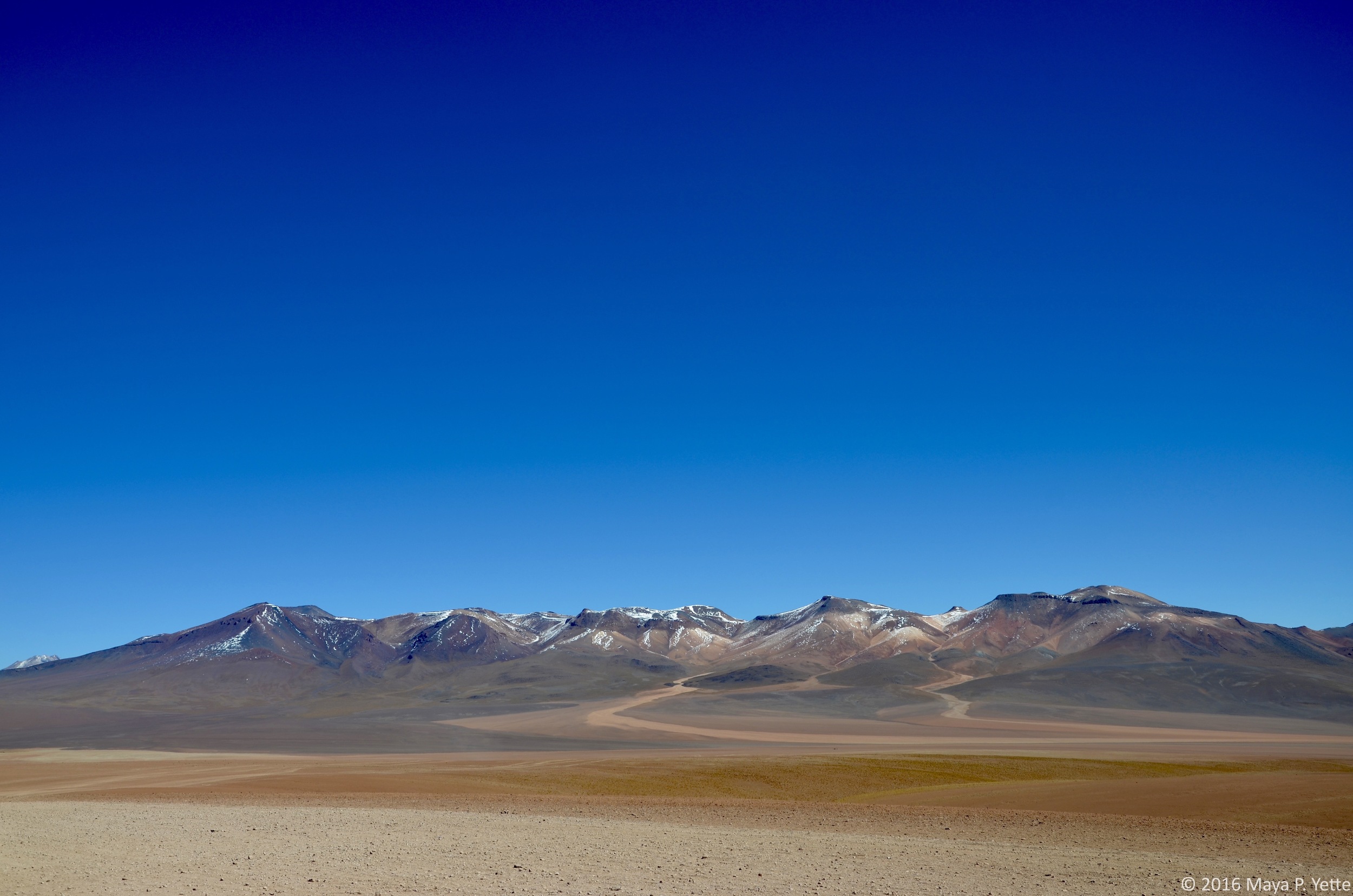
On our second day in the southwest region, with the salt flats behind us, we set out to see what else Bolivia had to offer. From pink lakes with flamingos to volcanoes everywhere we looked and more, it did not disappoint. For large parts of the day as we drove through vast expanses where it seemed like the only inhabitants were a few llamas or vicuñas, I felt like we must be on Mars, or at least what I imagine Mars to look like, with red, rocky land spreading out all around us. 

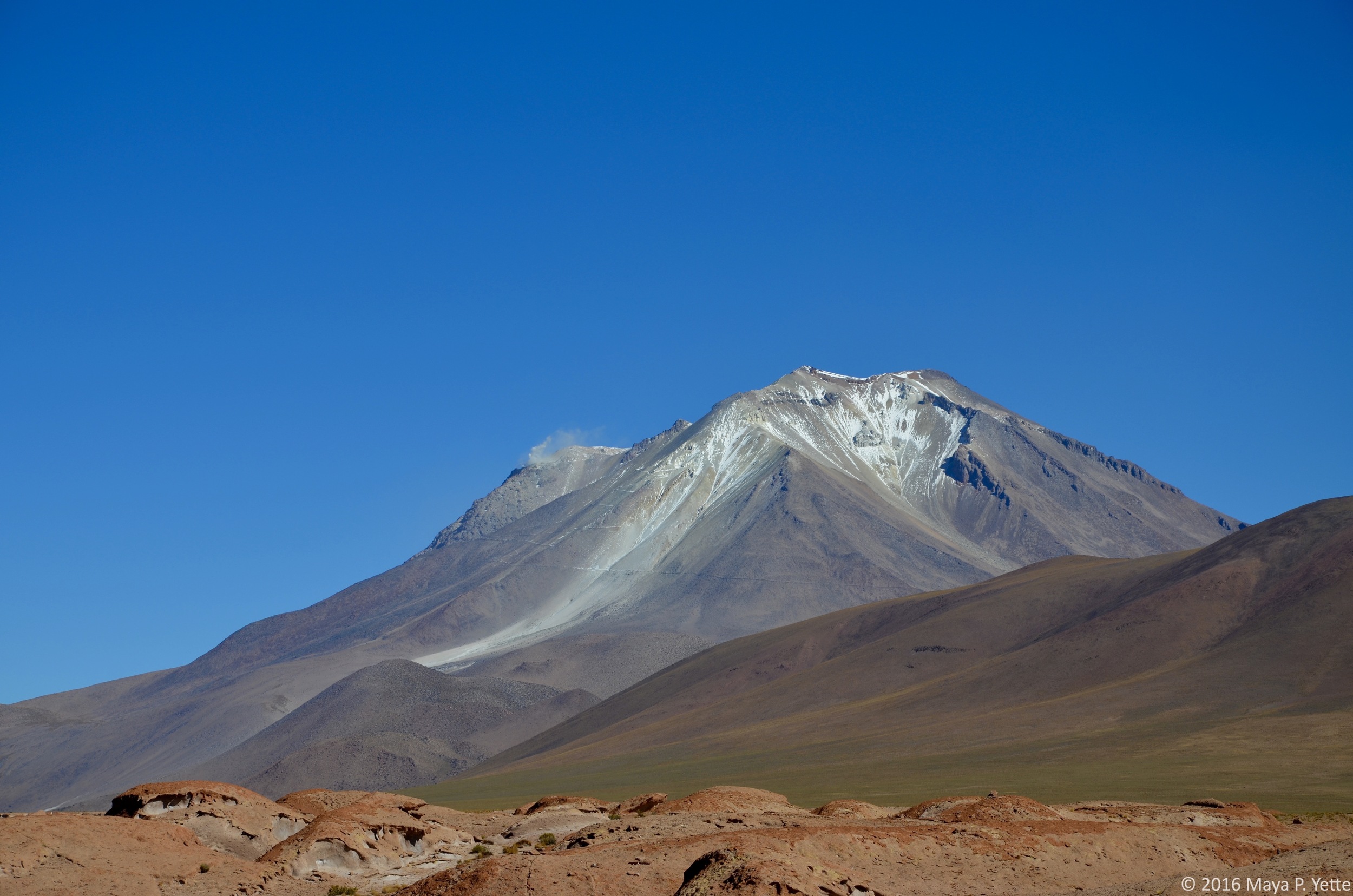
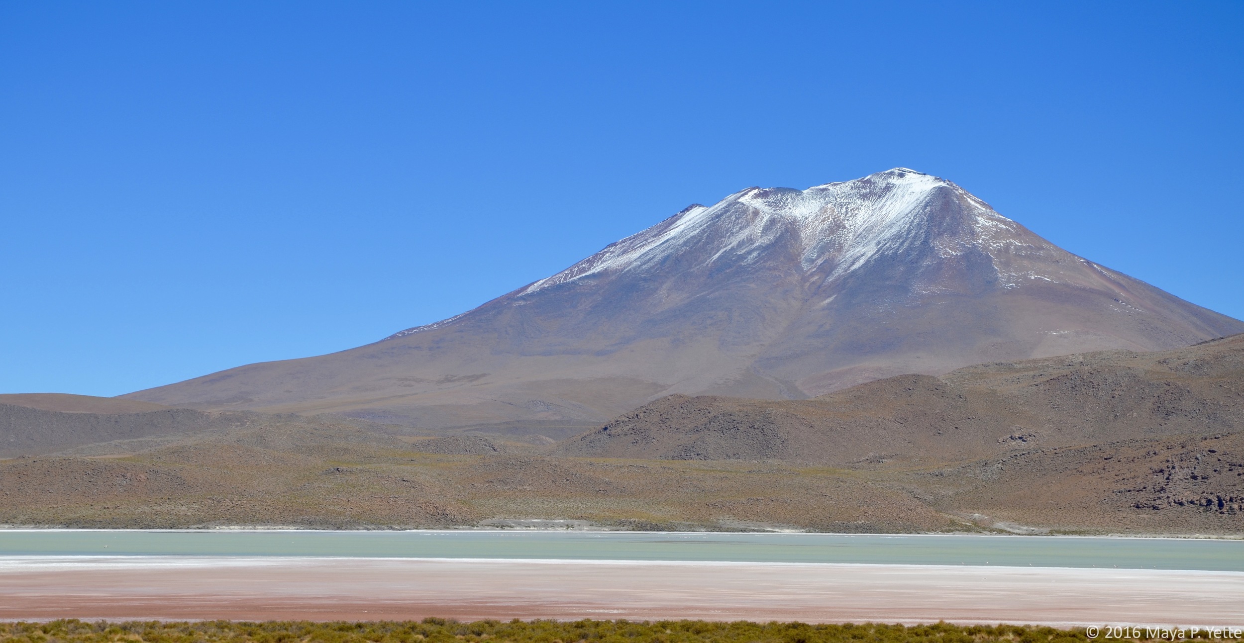
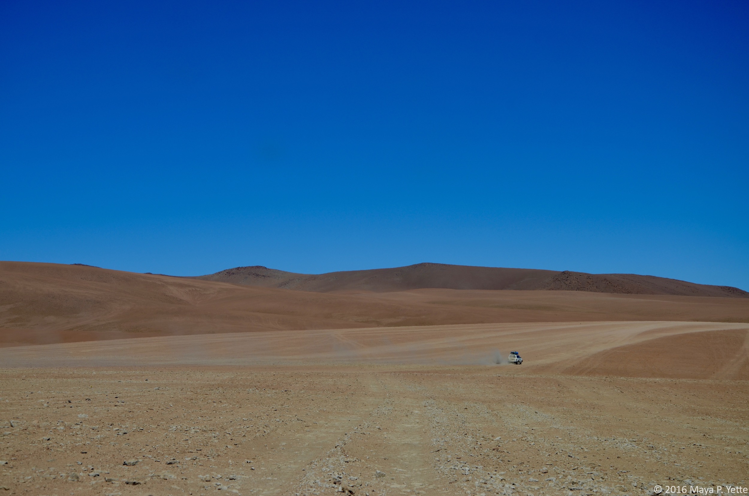
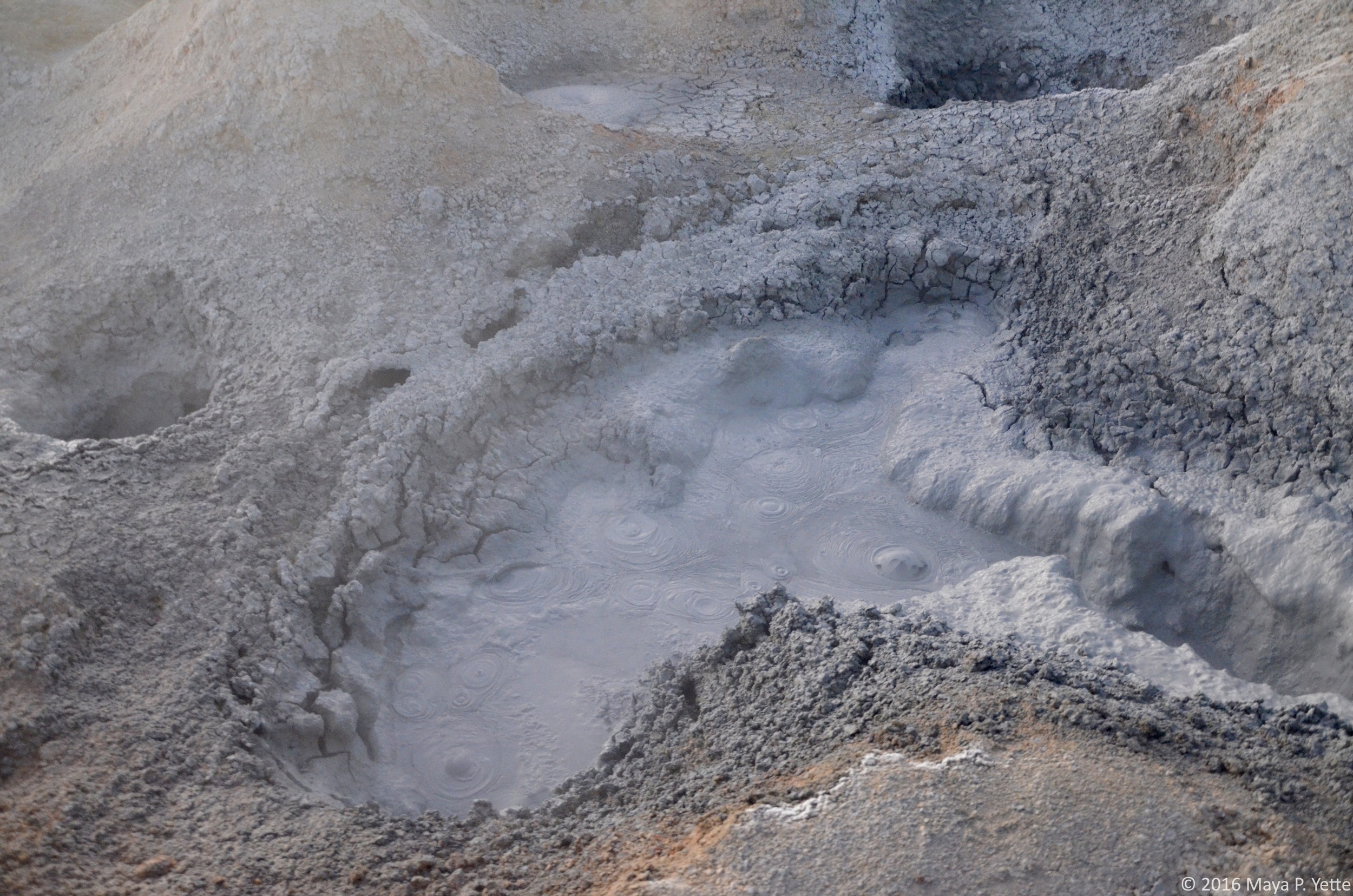
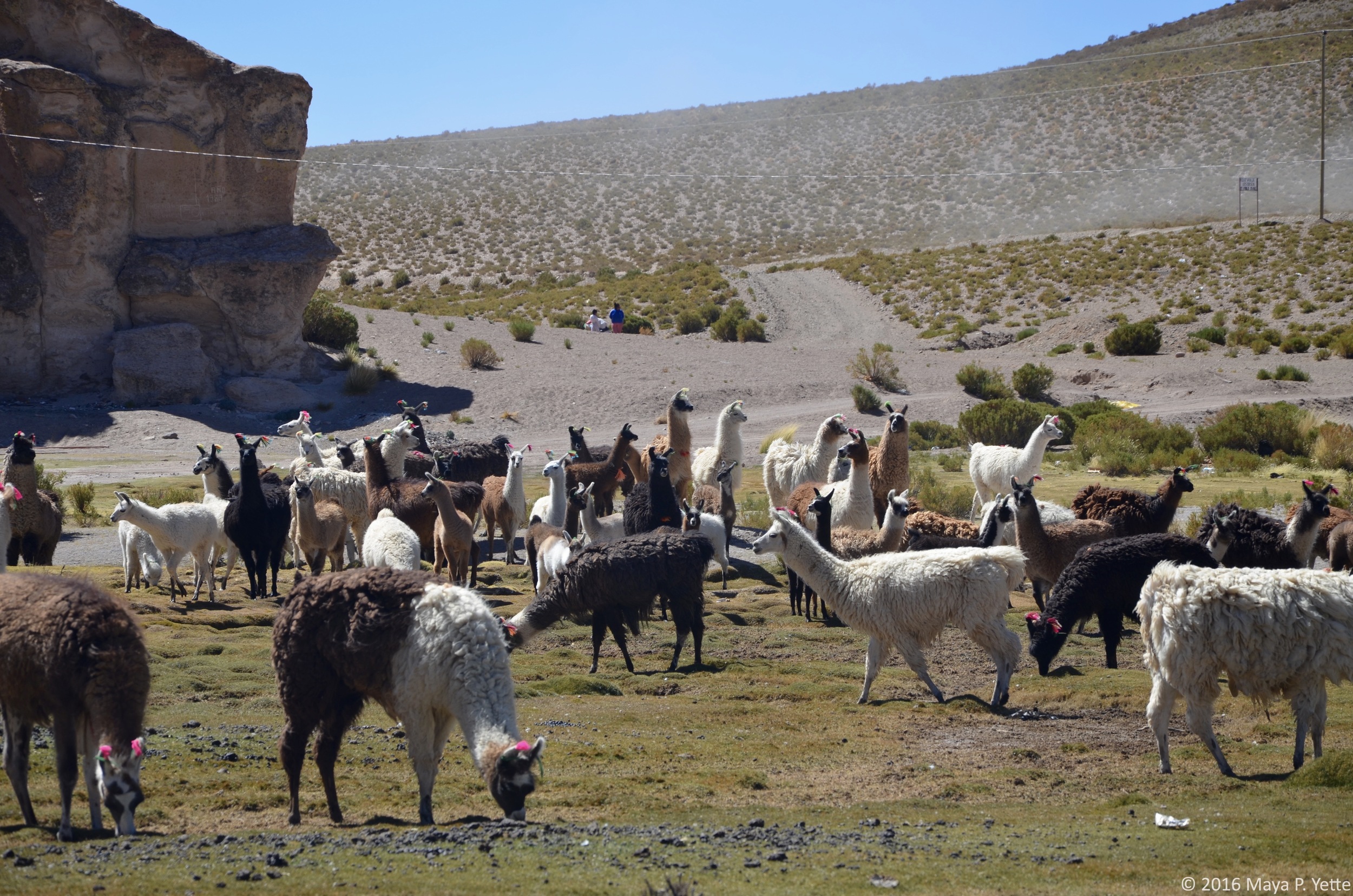
On our final day of the tour, we set out before sunrise to drive up into the mountains 5,000 meters above sea level. We saw geysers of smoke and bubbling sulfur all before the sun reached its peak in the sky. Because of the altitude it was also colder than any of us were prepared for and we quickly retreated to the relative warmth and comfort of Freddy’s jeep. After driving to view another lake and volcano combo, we drove to what is known as the Desierto de Dali (Dali’s Desert), for its similarities to one of the deserts in Dali’s famous painting (he is not known to have ever visited Bolivia, making the similarity all the more striking). Despite the frigid temperatures, some of us also braved the cold to enjoy some time in a natural hot springs. After drying off, we stopped in a little town called Mallku Villa Mar for lunch and walked among a field full of llamas before beginning the drive back to Uyuni. From there, I and a few others opted to catch a one hour flight back to La Paz instead of taking another overnight bus – so worth it!

Life on the Lake by Maya Yette

One Saturday morning I woke up early and headed to Copacabana, Bolivia with a few of my friends. Copacabana sits on the edge of Lake Titicaca, which is both the largest lake in South America and the highest navigable body of water in the world. The lake stretches between Bolivia on the east and Peru on the west. From La Paz, getting to Copacabana is an easy but cramped five-hour bus ride. When we arrived, we grabbed lunch in town, which was covered in what looked like snow (we later learned it had hailed that morning) and then caught a ferry that brought us to Isla del Sol (Island of the Sun) after an hour and a half crossing the lake.

Isla del Sol, home to about 800 families, sits on the Bolivian side of the lake and is believed by the Incas to be the birthplace of the sun. As we arrived at the dock on the southern side of the island, we were greeted by numerous cholitas and all of the donkeys that are used to carry goods across the island. There are no cars or paved roads on Isla del Sol, a fact that I didn’t fully appreciate until we were actually there. Isla del Sol is around 4,100 meters at its highest point, about the same as La Paz, but the air felt thinner there and I was winded more than normal walking up and down the hills that crisscross the island.

After we dropped our bags off at our hostel, we set out to explore. We hoped to reach one of the 80 Inca ruins on the island and hike up to the mirador, at the highest point on the island, where we would have a view of the island and the lake below. Isla del Sol is beautiful and at every turn you run into one of the many donkeys, llama or sheep that call the island home.

We walked and admired the view, stopping to take pictures along the way. Eventually, we realized that the Inca ruins we were in search of were back towards our hostel, in the opposite direction of the mirador. Knowing that we planned to see the more famous Inca ruins the next day, we scrapped those plans and stopped for a bottle of wine on a patio overlooking the lake. Sufficiently rested, we continued up to the mirador and were rewarded with beautiful vistas of Isla del Sol and Lake Titicaca.

On our way back down the mountain, we ran into some fellow Remotes who we did not know were also on Isla del Sol for the weekend. We ended up having dinner with them and then trekking back to our side of the island in the cold, dark and rain, with only our iPhone flashlights to guide us (and wondering the entire way whether we were stepping on mud or donkey droppings).

The rain did not abate overnight and on Sunday morning we woke up to a torrential downpour. We had to catch an 11:30 a.m. ferry back to Copacabana to get the bus to La Paz so we did not have time to wait the storm out. We hired a ferry to take us to the northern side of the island where there are pretty extensive Inca ruins. The Palacio del Inca is a huge complex of stone walls and doorways overlooking the lake, also known as El Laberinto (the Labyrinth). As we reached the top of the mountain where the ruins are situated, the rain slowed to a drizzle and we were able to enjoy our last morning on Isla del Sol, walking through the ruins, ducking through doorways and envisioning what life must have been like for the Incas on Lake Titicaca.

Lots to Love about La Paz by Maya Yette

I’ve been in La Paz, Bolivia for two weeks now and although I've been lucky and didn’t suffer the worst effects of altitude sickness (I’ve been told it feels like a really, really bad hangover complete with nausea and headache), I still find myself short of breath when walking up a flight of stairs or one of the many hilly streets throughout the city. La Paz is anywhere between about 10,000 feet to 13,000 feet above sea level depending on where you are in the city, enough to make it the highest de facto capital city in the world – de facto because Sucre is the true capital but La Paz actually houses more government departments.

Despite the minor inconveniences of not being able to catch my breath due to the altitude and pollution, the fact that the altitude makes me constantly sleepy, and the fact that I only remember about half the time that we’re not supposed to flush toilet paper here (seriously!), I’ve found myself enjoying La Paz more than I did Montevideo or Buenos Aires. So have many other people in Remote Year, notwithstanding the broken bones, salmonella and general illnesses that have plagued our group this month. Perhaps it’s because I had little to no expectations upon arriving in La Paz late on a Sunday night a couple weeks ago or perhaps it’s because Bolivia is the first country we’ve been to on Remote Year that really feels different. Around 60% of the population is indigenous (in Montevideo, all of the indigenous people were killed off and Buenos Aires’ population looks largely European as well). In Bolivia, there are “cholitas” (not to be confused with “cholas”, which the cholitas view as a derogatory term) everywhere, walking around proudly in their colorful flowing skirts and top hats, long braids flowing down their backs. The traffic in La Paz is terrible and car horns serve as a constant soundtrack when walking around the city. La Paz has a population of roughly 1.8 million people but feels infinitely more crowded and busy than the other South American cities I’ve lived in for the past two months.

There is no shortage of things to do in La Paz and the surrounding Bolivian countryside and we’ve all quickly come to rue the fact that we only have one month in this amazing country. My first week in La Paz was also my first week on a new job, so I’ve had to make the most of my nights and weekends. From walking tours around the Sopocachi neighborhood where we’re staying this month, to dinners at Gustu and Ali Pacha, both of which offer delicious tasting menus, and rides up the cable car (in my opinion, La Paz’s best form of public transportation) from La Paz to the neighboring city of El Alto, it has not been hard.

El Alto is also home to the infamous and bizarre “Cholita Wrestling” show. Inspired by the WWE in the U.S. and lucha libre in Mexico, the cholitas deck themselves out in fantastic costumes and put on a show that is meant to empower the women and entertain their audience. Bookended by men’s wrestling matches, the cholitas are clearly the highlight of the show and what locals and tourists alike come out every Thursday and Sunday to witness.

On the weekends, I typically find myself heading out of the city limits to explore everything else that Bolivia has to offer (I wrote most of this from a bus heading back to La Paz from a weekend visit to Isla del Sol, but more about that in a later post). Last weekend, some of my friends and I went mountain biking on Bolivia’s “Death Road”, known as one of the world’s most dangerous roads.

The first 45 minutes of the ride are along a winding, paved highway that offers breathtaking views of the mountains and cold temperatures that require gloves, hats and layers of clothing underneath the helmet, jacket and pants supplied by our tour operator. Once we reached the start of the actual Death Road, which is entirely dirt and rocks, we were literally among the clouds and could not see anything but their white nebulousness off the side of the mountain. As we descended the narrow road into the jungle, the clouds cleared, we shed layers as the temperature increased and we never let go of the brakes on our bikes. It was really hard to fully appreciate the beauty around us while riding the bikes because I was so focused on not falling or riding over the edge of the cliff (there were no guardrails and it’s not called Death Road for nothing). Thankfully, we stopped often to rest and the guides were able to take lots of photos of us. During the last twenty minutes of our 40-mile ride the skies opened up and the dark clouds we’d been trying to out-bike all afternoon finally caught up with us. We arrived to the bottom of the mountain soaking wet, but with adrenaline coursing through our veins. It was a good thing too, because we still had to head back up the mountain to go zip lining across the jungle!